Project overview
We developed models to help the BC Government more accurately estimate water availability in particular watersheds to enable them to better allocate water resources in BC.
- Client: Ministry of Forests, Lands and Natural Resource Operations
- Location: BC Lower Mainland
- Duration: 2015
The challenge
Surface water availability is a key consideration for Ministry of Forests, Lands and Natural Resource Operations (FLNRO) when evaluating water resource allocations in BC. However, estimating water availability for a particular watershed can be challenging given the potentially conflicting water uses, varied physical characteristics, diverse hydrology, and seasonal variables.
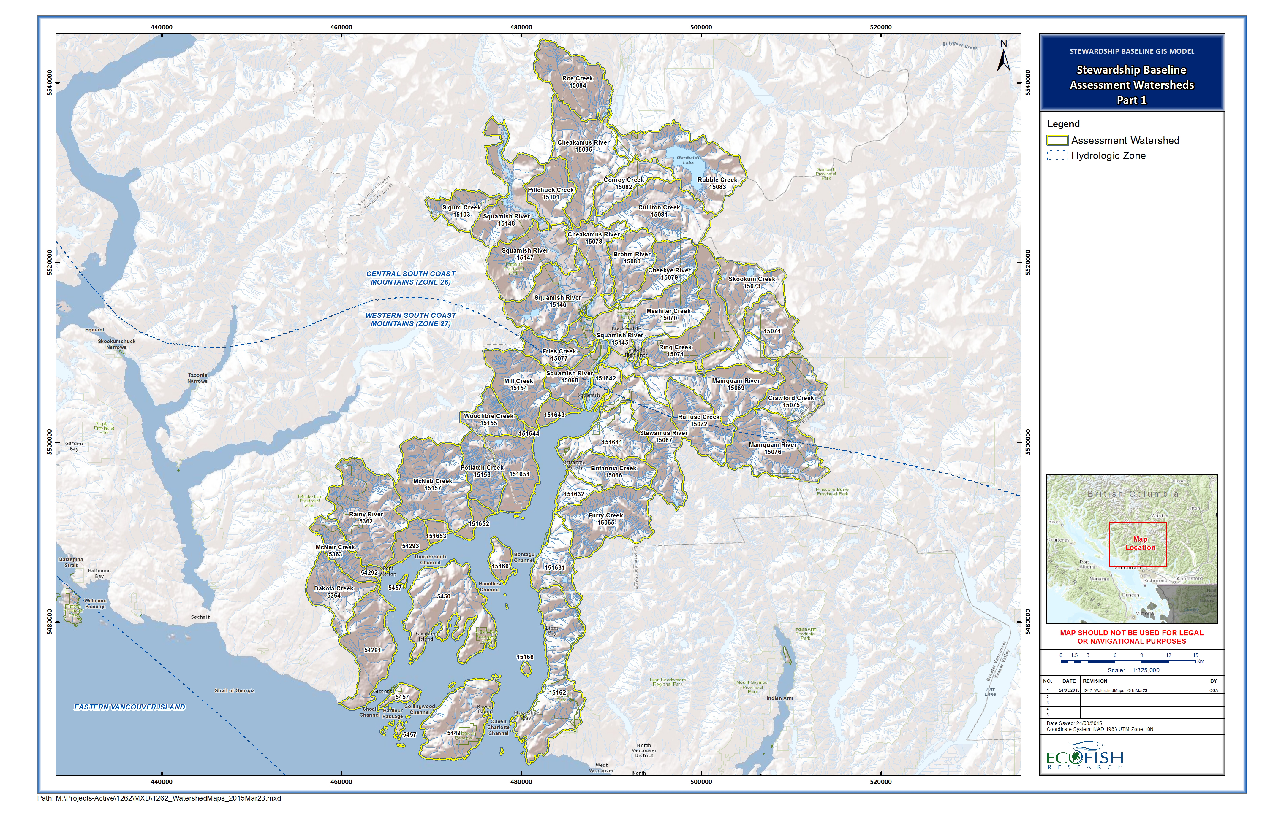
FLNRO asked Ecofish to develop methods and process based modelling approaches to estimate monthly water availability in 70 Freshwater Atlas (FWA) Assessment Watersheds in the BC Lower Mainland.
The work
Estimating key metrics and water availability
Ecofish water resource engineers and hydrologists estimated key metrics and water availability on a mean monthly basis by first estimating natural streamflow in each assessment watershed, and then subtracting the total streamflow allocated under provincial water licenses. We developed a series of multiple regression models to predict mean annual discharge, mean annual 7-day low flow, and mean monthly discharges (MMDs) for each assessment watershed.
predictor variables and data sources
The candidate predictor variables for the models included drainage area, mean annual precipitation, mean annual temperature, glaciated percentage of catchment, lake percentage of catchment, and hypsometric variables including minimum, mean, and maximum elevation, elevation for which 70% of the catchment is lower, basin relief, and basin relief divided by drainage area. The data sources included WSC basin characteristics compiled in previous studies, historical climate data from ClimateWNA, and assessment watershed characteristics provided by FLNRO or from DataBC.
The results
Each of the candidate predictor variables were selected in one or more of the models except minimum elevation, maximum elevation, elevation for which 70% of the catchment is lower, and basin relief divided by drainage area. We formulated recommendations to improve on the accuracy of the water availability predictions, including:
- improving the current modelling process with additional provincial data
- developing a mixed effects model using hydro-climatic time series along with additional data
- implementing a process based water balance model using time series data and a spatial grid of physio-climatic variables.